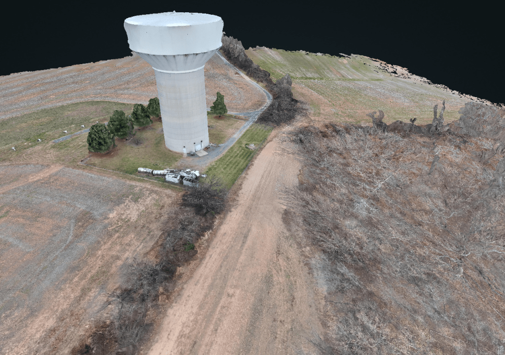
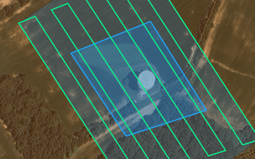
Our 3D Modeling & Digital Twins Workflow
- Planned capture missions based on site geometry and structure
- Grid and oblique flight paths to fully resolve vertical and complex surfaces
- Controlled image overlap to ensure consistent alignment and point density
- Altitude and camera angle selection tailored to the subject being modeled
- Capture designed for reconstruction accuracy, not visual effect
- Reduced occlusions and surface gaps in complex structures
- Cleaner geometry and fewer artifacts during model generation
- Measurement-ready 3D outputs suitable for planning and documentation

What These Models Are Used For
Our 3D models & Digital Twins are created to support planning, documentation, and spatial understanding—not just visualization.
- Review sites remotely with accurate scale and perspective
- Understand structure, terrain, and surrounding context
- Reference existing conditions during planning or inspection
- Share a common spatial view across stakeholders
These models are intended for more than viewing.
They are used to review existing conditions, understand spatial relationships, and support planning and documentation when on-site access is limited or impractical. Each model is built to be measurable, navigable, and grounded in real-world geometry, making it suitable for technical review as well as visual reference.